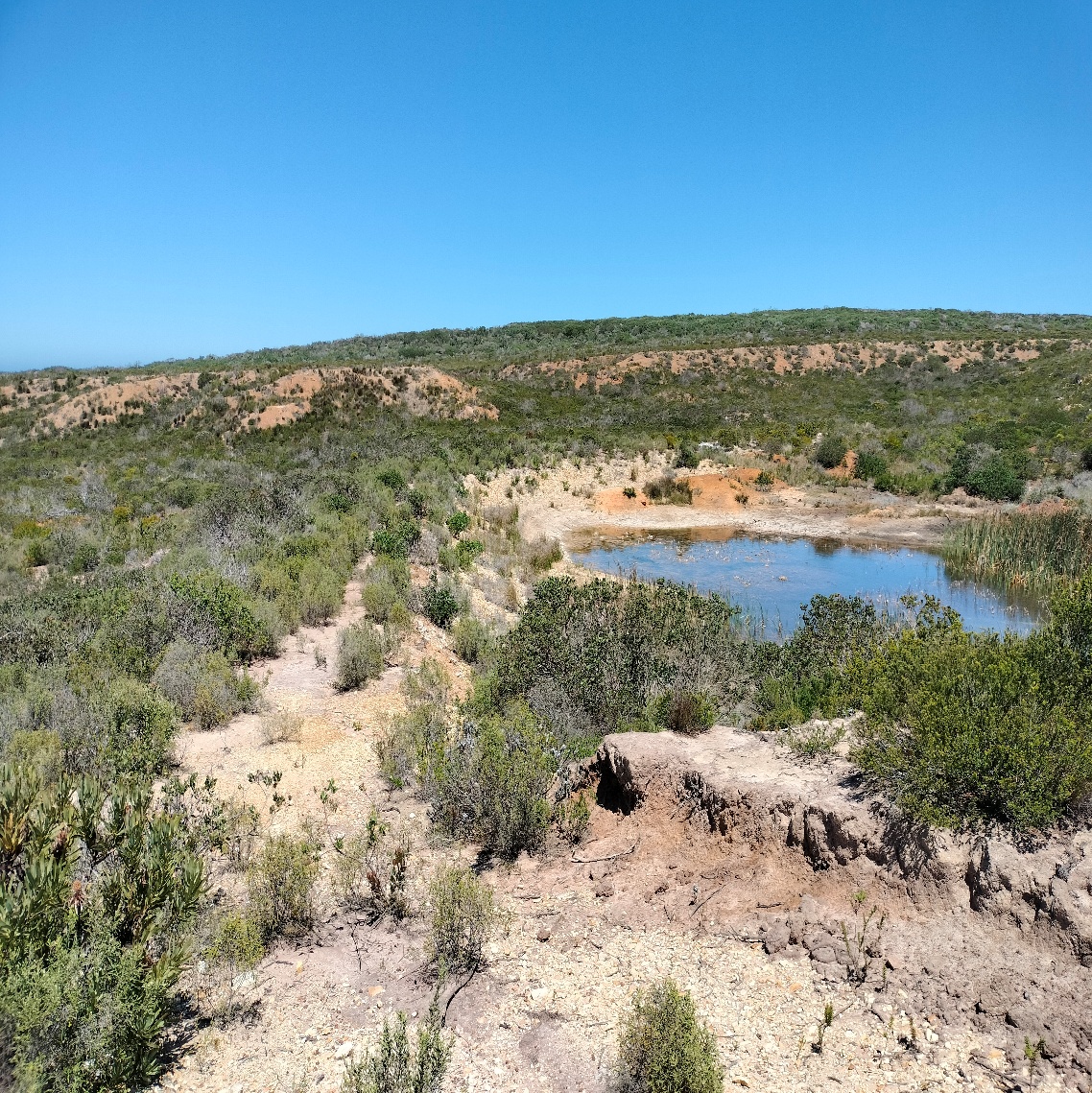
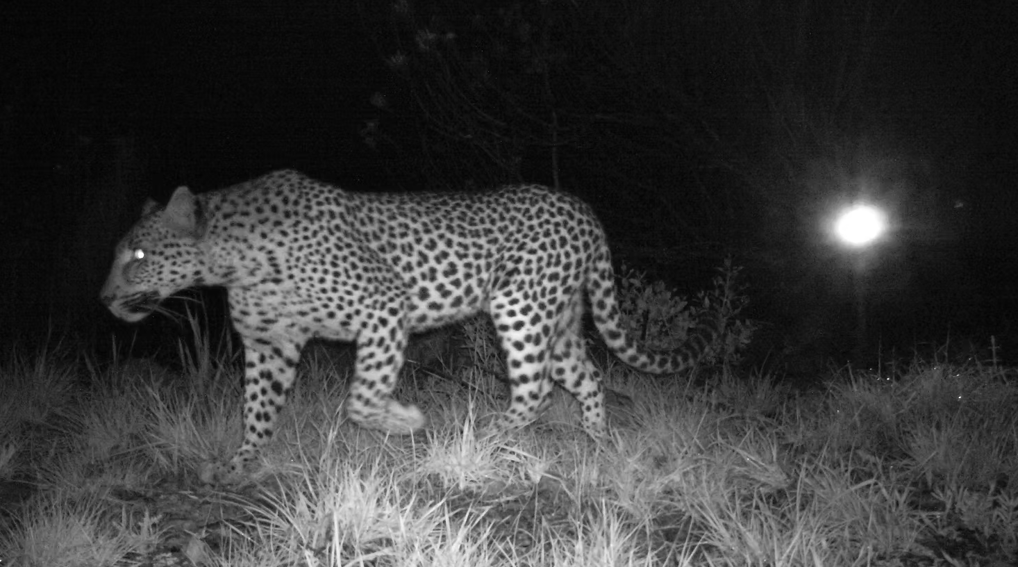
A 121-unit upmarket retirement complex on Portion 59, and on Portion 62 a 12,000m² commercial tourism node — branded the "Museum of Mankind" — comprising a 500-seat outdoor amphitheatre, a restaurant and deli, a conference and wedding venue, 19 boutique self-catering units, and hardstand and overflow parking for 552 cars and 6 buses. On 55.78 hectares of Critical Biodiversity Area, inside the Garden Route National Park buffer zone, with leopard and aardvark — both IUCN Vulnerable — confirmed on or adjacent to the site, and next to the grave of A.A.S. Le Fleur, the Griqua spiritual leader known as "The Reformer."
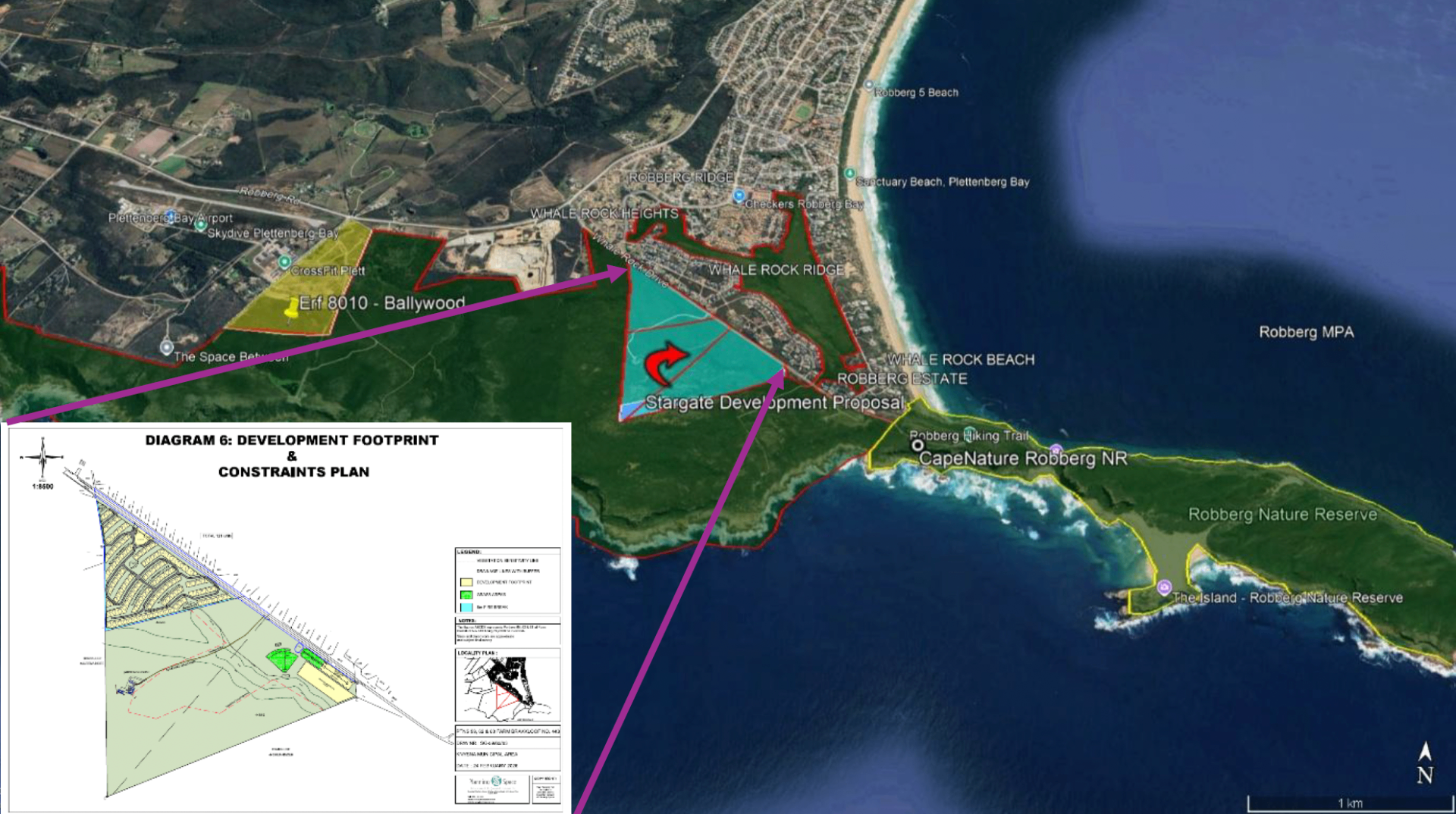
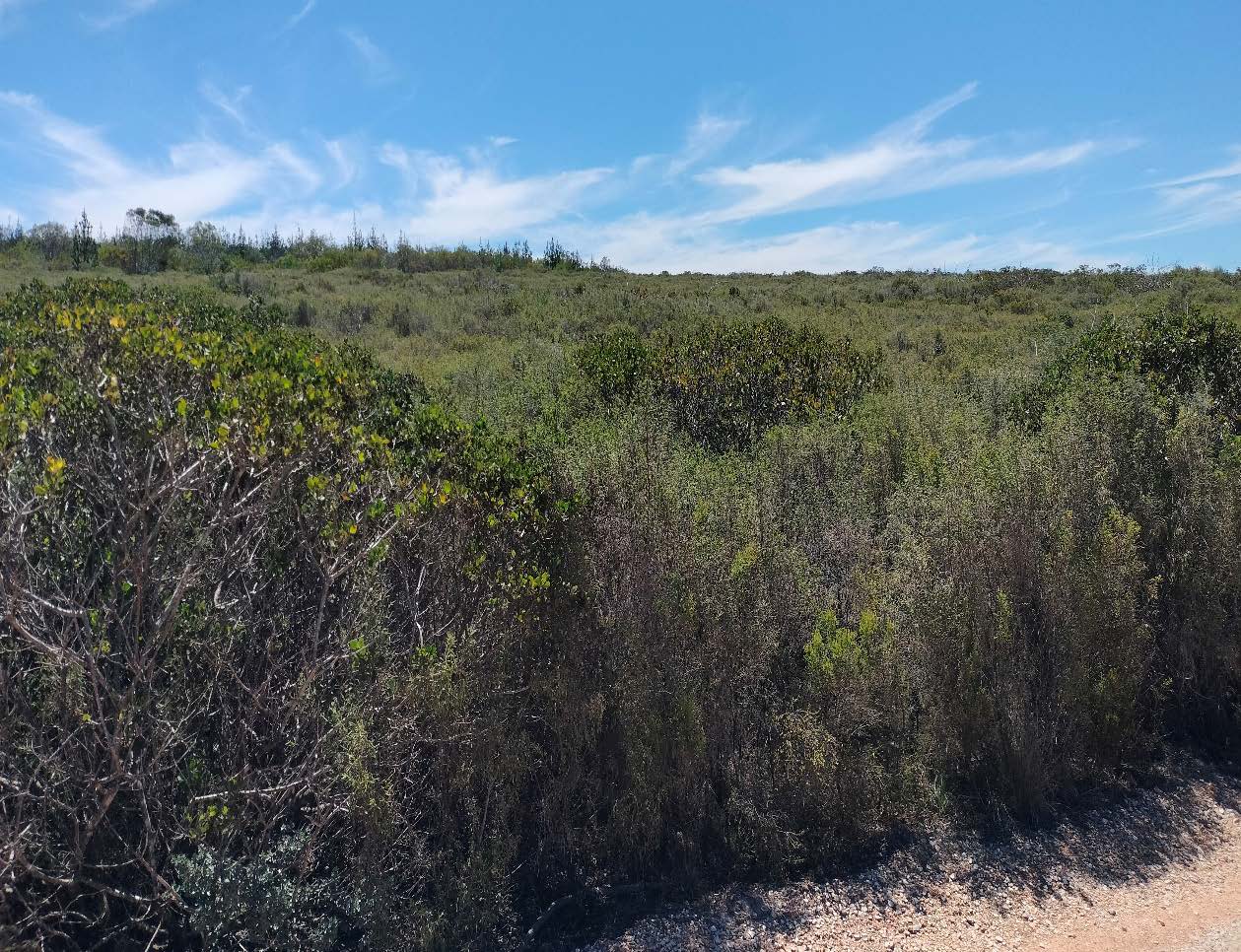
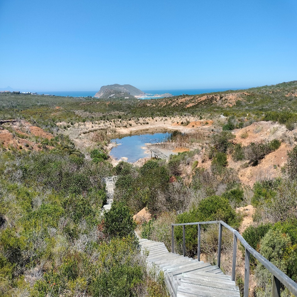
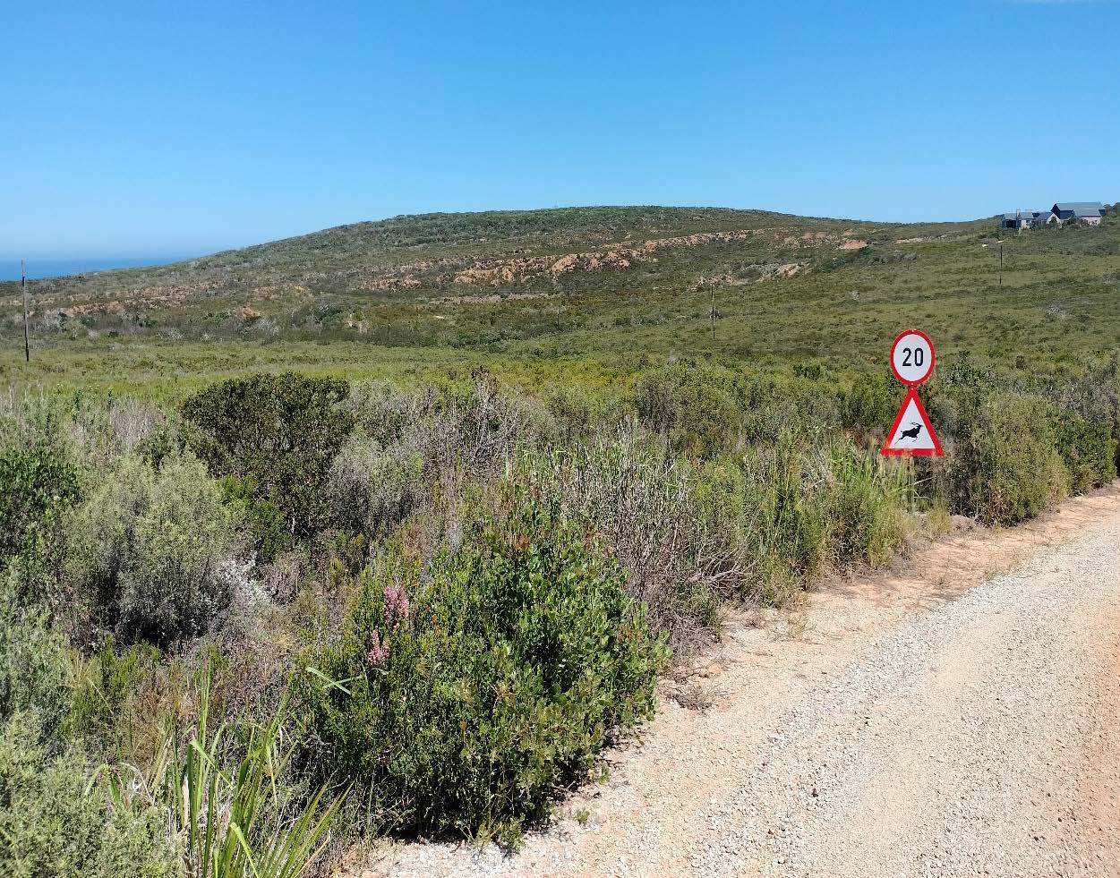
South of Robberg Reserve Road is the wild, undeveloped side — locally known as Plett's Wildside. The Wildside properties form the ecological and physical chain between the Robberg vlei municipal open space to the north, the Robberg Coastal Corridor Protected Environment in the middle, and the Robberg Nature Reserve and Marine Protected Area to the south-east. The Star Gate site sits at the narrowest point of that chain.
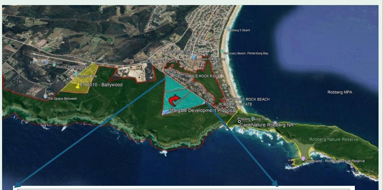
Eco Route's Site Development Plan as submitted in the Pre-Application Basic Assessment Report, April 2026. Portion 59 to be rezoned to General Residential I for the retirement complex. Portions 62 and 63 to be rezoned to Open Space III, with the cultural/tourism node (Museum of Mankind) on Portion 62 and the remainder offered to the Robberg Coastal Corridor.
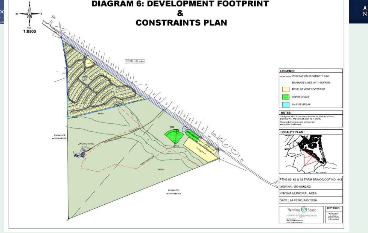
Diagram 6 — Development Footprint & Constraints Plan · Portions 59, 62 & 63 of Farm Brakkloof 443 (55.279 ha). Drawing SG-59/62/63, Planning Space, 24 February 2026. Reproduced in Eco Route's Pre-Application Basic Assessment Report, April 2026.
Three farm portions that together cover 55.78 ha on the south-western edge of Plettenberg Bay, between Robberg Road and the boundary of the Robberg Coastal Corridor. Currently zoned Agriculture I. Containing thousands of Early Stone Age artefacts, a Provincial Heritage-classified landscape, and the grave of A.A.S. Le Fleur on the south-eastern boundary.

The same property the developer proposes for a private "Museum of Mankind" already contains the heritage record it claims to celebrate. This is documented in the official Heritage Impact Assessment that Heritage Western Cape required for this site — a process that the developer has not yet completed for the 2026 application.
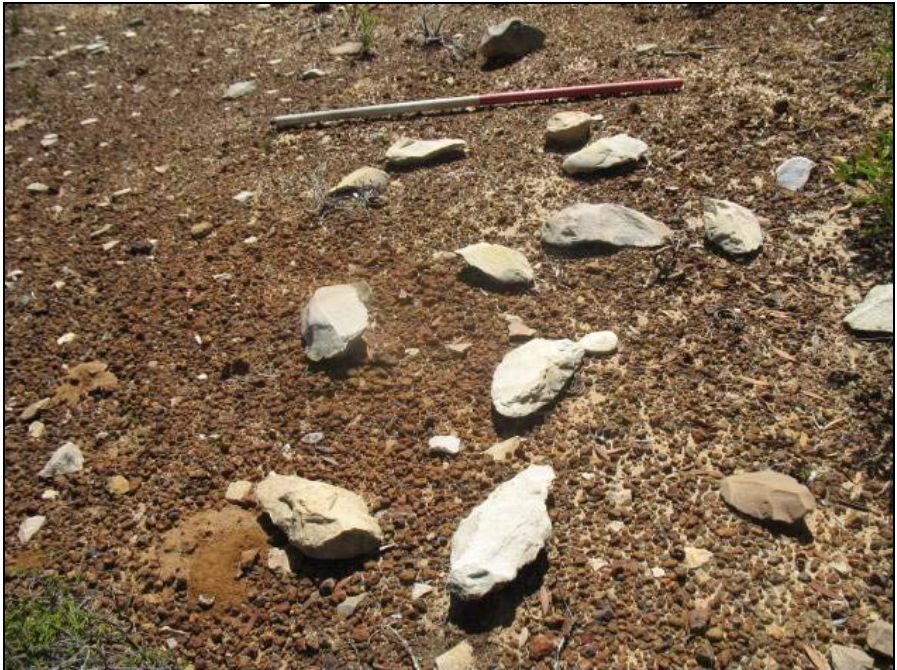
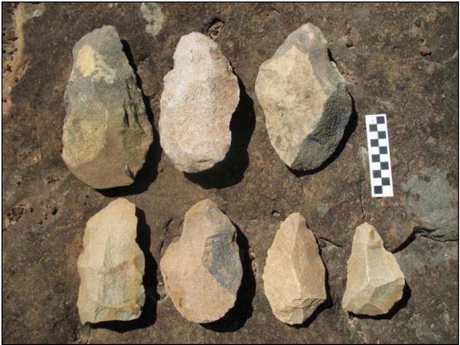
The first archaeological survey of the property, by Jonathan Kaplan in 2010, recorded several thousand Early Stone Age flake tools — including handaxes — related to an important Acheulean Stone Age site. Two further specialist studies in 2012 confirmed and extended these findings.
Will Archer's reconnaissance study identified the old quarry on Portion 63 as a Middle-Pleistocene locality where both raw materials were procured and artefacts were made in situ — a prehistoric stone-tool factory. Aikman Associates' Heritage Impact Assessment (HWC Case ID 1136) classified the entire property as part of South Africa's National Estate under Section 3 of the National Heritage Resources Act.
The property as a whole must be considered to be part of the National Estate in terms of Section 3 (1)(c) because of its potential to yield information that will contribute to an understanding of South Africa's cultural heritage. — Aikman Associates, HIA 2012
The 2012 HIA recommended that the Quarry Site be declared a No-Go development area with a 100-metre buffer. Heritage Western Cape has required a new Heritage Impact Assessment for the 2026 application. The developer has not yet produced it.
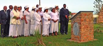
The grave of A.A.S. Le Fleur — leader of the Griqua people who trekked to this coast in 1939 — sits on the south-eastern boundary of the Star Gate property. It is a place of active pilgrimage. The Star Gate Pre-Application BAR makes no reference to it. No consultation with the Griqua community is recorded.
Documented in the 2012 Aikman Associates Heritage Impact Assessment, HWC Case ID 1136.
Star Gate is a single-shareholder operation. The land sits in the NCH Trust, registered IT 596/2012. The trading vehicle, Star Gate Innovations (Pty) Ltd, was registered in 2014. Both are controlled by Neil Christopher Hellmann.
The Pre-Application Basic Assessment Report submitted to the Department of Environmental Affairs and Development Planning lists the applicant as Star Gate Innovations (Pty) Ltd, with the landowner as the NCH Trust. The contact person on both is the same — Neil Christopher Hellmann.
The application includes, as Appendix E2, a letter signed by Mr Hellmann offering to incorporate the unaffected portions of the property into the Robberg Coastal Corridor. The developer's argument: the conservation of part of the land justifies the commercial development of the rest.
Inclusion of part of the land in a Protected Environment does not legitimise commercial development on the rest of it. The conservation corridor is being used as cover.
The Pre-Application BAR also disputes five separate classifications produced by the national Environmental Screening Tool — including the Very High aquatic sensitivity rating, the High heritage sensitivity rating, the Critical Biodiversity Area designation, and the Critically Endangered Knysna Sand Fynbos classification. In each case, the dispute relies on consultants paid by the applicant.
The Star Gate site has been studied for sixteen years. Heritage Western Cape required a Heritage Impact Assessment in 2011. A new application has now been submitted under a different landowner and a different EAP, with the older studies still being relied on.